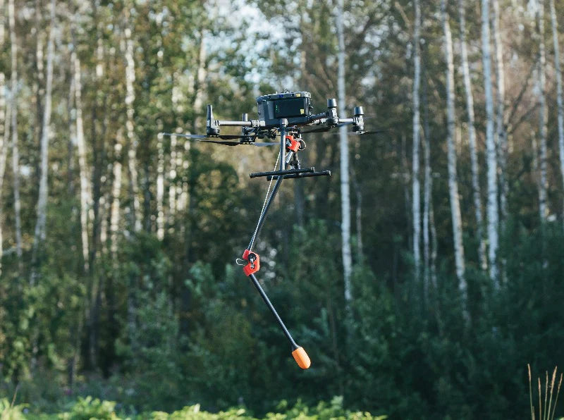
SPH MagNimbus Magnetometer
Overview
Ultra-sensitive airborne integrated magnetometer system powered by QuSpin Gen-2 atomic total-field magnetometer sensors
Typical applications are:
- Searching for UXO (unexploded ordnance) and landmines in metallic casings
- Tramp metals and lost GET (ground engagement tools) detection
- Locating buried infrastructure (metal pipes and shielded cables)
- Environmental surveys for abandoned wells, pipes, and storage tanks quickly and with precise positioning
- Geology and minerals prospecting: surveys for regional variations in the magnetic field
- Archaeology
Unique system design allows to fly with extremely low surface-to-sensor clearance starting from just couple of dozens of centimeters. If the sensor will touch the ground or obstacle/vegetation that will not lead to the drone crash. That capability is extremely important for searching for small UXO items over the fields with vegetation.
Self-foldable sensor mount allows easy take-off and landing without excess requirements for drone operator qualification as it is for magnetic sensors on suspension cords.
System variants
MagNIMBUS comes in two possible configurations:
- Vertical gradiometer. This configuration greatly simplifies data processing and makes magnetic base station not necessary.
-
Configuration with single sensor with foldable mount. Detection capabilities are the same as for gradiometer setup, but requires experienced specialists for data processing, magnetic base station is recommended in case of surveys in proximity of sources of magnetic fields.
Components
Main components of the system:
- Recommended drone: DJI M350 RTK/M300 RTK. Standard kit comes with all mountings/cables for this drone, sets for other types of drones, including Pixhawk-based, are available by request.
- Foldable mount with build-in QuSpin Gen-2 magnetic field sensor.
- Mast with QuSpin Gen-2 sensor for vertical gradiometer configuration.
- SkyHub onboard computer – acts as datalogger for magnetic field sensors and implements terrain following mode for DJI drones.
- Altimeter (laser or radar).
- UgCS Expert flight planning/management software.
Recommended software for data processing: Geosoft Oasis montaj.
UXO/landmines detection note
The system is capable to detect a range of items starting from hand grenades (estimated sensor-target distance for robust detection for target like F1 fragmentation hand grenade is 1.0m) till big UXO like aerial bombs at the distance of few meters.
While the system is capable to detect some types of landmines (TM-62M, OZM-72 and similar types with considerable amount of ferrous metal), landmines search is not a direct application of the system as it can’t detect most of types of landmines. That means that the system never should be used to confirm absence of landmines (and UXO) in certain area but it can be valuable asset during Non-Technical Survey (NTS) or Technical Survey (TS) to detect evidence of presence of UXO/landmines with considerable amount of ferrous metals.
Data examples
Single-sensor configuration, UXO GeoMIL test range
Single-sensor configuration, Balozi test field
Gradiometer configuration, Balozi test field
HS Code: 90158020 (meteorological, hydrological, geophysical instrument)
Size & weight of MagNIMBUS (single-sensor):
- folded: 640x180x75 mm
- unfolded: 1100x310x75 mm
- weight: 570g / 1.26 lbs
- weight of mounting for DJI M350/M300: 100g
Transportation case:
- dimensions: 846x427x167 mm
- weight: 6.9 kg / 15.25 lbs (with heavy payload mounting included)
Lead time: 4 weeks


