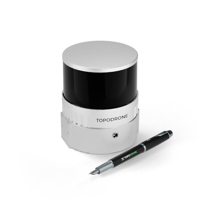

TopoDrone Lidar 200+
Laser scanner based on Hesai XT32M2X, 300 m working range, 200 m working flight altitude, triple return mode up to 1,920,000 points per second, 3-5 cm XYZ accuracy, 360° FOV, built-in 200 Hz IMU with 0.07/0.01 accuracy, built-in GNSS receiver, weight 0.8 kg.
- The most compact 360° LiDAR on the market.
- The lightest LiDAR of the product line - 800 g.
- The highest working flight altitude - 200 m.
- Triple return mode, the others have dual return.
- Highest scanning frequency - 1 920 000 PPS.
Specifications
| General | |
| Country of origin | Switzerland |
| Year of release | 2023 |
| Warranty | 12 month |
| Weight | 800 g |
| Operating temperature range | -4°F to 140°F |
| Storage Temp | -30°F to 185°F |
| LiDAR System | |
| Sensor type | XT32M2X |
| Sensor Weight | 490g / 1.08lbs |
| Recording data to internal memory | Yes |
| Recording data to a flash card | Yes |
| Camera connection | Yes |
| Built-in IMU | Yes |
| Built-in GNSS module | Yes |
| Laser Sensor | |
| Working Range | 300m / 1000ft |
| Working Flight Altitude | 200 m |
| Sensor Accuracy | 3-5 cm |
| Number of scanning beams | 32 |
| Horizontal FOV | 360° |
| Vertical FOV | 40.3° |
| Horizontal Resolution | 0.09° |
| Vertical Resolution | 1.3° |
| Scanning frequency (single reflection) | 640000 |
| Scanning frequency (double reflection) | 1280000 |
| Scanning frequency (triple reflection) | 1920000 |
| Refresh Rate | 5-20 Hz |
| Laser Wavelength | 905 nm Class 1 eye safe |
| Operating Voltage | 9 V – 36 V |
| Power Consumption | 10 W |
| Output-UDP/IP Ethernet | 100BASE-TX |
| Ethernet Connection | 100 Mbps |
| Data synchronization | GPS/PTP |
| Water Resistance | IP6K7 |
| IMU | |
| IMU Weight | 35 g |
| Operating frequency | 200 Hz |
| Heading accuracy (°, 1σ),0 | 7 |
| Pitch accuracy (°, 1σ),0 | 1 |
| Roll accuracy (°, 1σ),0 | 1 |
| GNSS receiver | |
| PPK mode | Yes |
| Number of channels | 184 |
| Frequency | 10 Hz |
| Data Accuracy | 3-5 cm |
| GPS | L1C/A, L2C |
| GLONASS | L1OF, L2OF |
| BeiDou | B1I, B2I |
| Galileo | E1B/C, E5b |
| SBAS | L1C/A |
| QZSS | L1C/A, L1S, L2C |
| Working without GCPs | Yes |
| Recommended radius to the base station | 6 miles |
Features
- Affordability. We work hard to provide the lowest prices for LiDARs in its class.
- Performance. Covers over 2 sq. km. of territory in one flight from a 200 m altitude.
- Accuracy. Very precise and thin point cloud due to modern laser sensor, built-in high precision IMU and integrated GNSS receiver.
- Mobility. LiDAR 3 in 1: can be mounted not only on the drone, but also on a car and a surveying backpack.
- Autonomy. Completely autonomous LiDAR missions when mounted on the DJI Matrice 300 RTK.
- Software. Provides full processing cycle from trajectory calculation to point cloud generation with the required coordinate system, strip adjustment and SLAM algorithms for data processing in conditions of insufficient GNSS signal are supported.
- Integration. The laser scanner can work on any drone, is fully compatible with TOPODRONE P24 and P61 photogrammetric cameras, the camera can be connected to the laser scanner, a fixed installation on LiDAR, as well as an option with installation of the camera on a 3-axis gimbal.
Inside the Box
-
T1 * TOPODRONE LiDAR 200+
-
1 * Drone mount
-
1 * Antenna cable
-
1 * GNSS antenna
-
1 * Flash card
-
1 * Cable kit
-
1 * Carrying case
Comparison
| TOPODRONE 200+ | TOPODRONE 100+ | TOPODRONE 100 | |
|---|---|---|---|
| Weight | 800 g | 1000 g | 1000 g |
| Working Range | 300 m | 120 m | 120 m |
| Working Flight Altitude | 200 m | 100 m | 100 m |
| Number of Lines | 32 | 32 | 16 |
| PPS - Single Return | 640 000 | 640 000 | 320 000 |
| PPS - Dual Return | 1 280 000 | 1 280 000 |
640 000 |
| PPS - Triple Return | 1 920 000 | n/a |
n/a |
Advantages of TopoDrone System
-
Survey flight can be prepared in any mission planning software (GS Pro, MapPilot, UgCS etc) and performed in automatic mode. You don’t need to have professional pilot skills.
-
High precision orthomosaics or 3D model can be created without using GCPs. You no longer have to lay down GCPs or just minimize their number, saving countless hours and labor costs.
-
Survey grade L1/L2 GPS/GLONASS/BeiDou/Galileo GNSS receiver is integrated with professional calibrated camera without any changes in side of the drone saving the manufacturer warranty.
-
Professional Helix type antenna provides high quality signal with low level of noise.
-
Position of the antenna under the center of camera and correction of the antenna tilt with using of IMU data insure better accuracy during photogrammetry processing.
-
The lightweight upgrade kit and removable antenna mount allows carrying your drone in a standard DJI case. It has a small weight and dimensions, is produced in large amounts on the factory in accordance with high quality Swiss standards.
-
You can use Metashape or Pix4Dmapper, etc. software are turn your images into highly precise, georeferenced 2D maps and 3D models without ground control points (GCP).
VIDEOS
The proven TopoLidar 100 sensor will now have the option of having a high res camera attached. However, flying only the sensor (no camera attached) and a separate photogrammetry mission is also a very good solution and work flow.